Lighthouse - www.WhalingCity.net www.WhalingCity.net
New Bedford, Massachusetts
Sperm Whale -  WWW.WhalingCity.Net -  © Roger Chartier
Home Page
Pictures and History
Places and Their History
Theaters and Entertainment
People Pics and Biographies
Whaling Images and History
Mayors List
City Parks
New Bedford Maps
New Bedford Videos
New Bedford Books, Etc.
Festivals and Fairs
Function Halls - Restaurants
Local Links
Things to do
New Bedford City Directories
Lewis temple Toggle Iron - www.WhalingCity.net
Chronological History
Local History - 1600's to 1699
Local History 1700 - 1749
Local History 1750 - 1777
Local Revolutionary War 1778
Local History 1779 - 1799
Local History 1800 - 1819
Local History 1820 - 1829
Local History 1830 - 1839
Local History 1840 - 1849
Local History 1850 - 1858
Local History 1859 Fires!
Local History 1860 - 1869
Local History 1870 - 1879
Local History 1880 - 1889
Local History 1890 - 1899
Local History 1900's
Local History 1900 - 1909
Local History 1910 - 1919
Local History 1920 - 1929
Local History 1930 - 1939
Local History 1940 - 1949
Local History 1950 - 1959
Local History 1960 - 1969
Local History 1970 - 1979
Local History 1980 - 1989
Local History 1990 - 1999
Local History 2000 - 2009
Local History 2010
Local History 2011
Contact webmaster
This site - work in progress.

If you have any public domain photographs of historical interest to donate, whether scanned or printed please contact the webmaster, Roger Chartier and your submission will be credited if it is displayed on this site.

By Roger Chartier


1900's - New Bedford - Fairhaven Bridge

This 1900's painting could be from a photograph from a tall building or an imagined perspective.

There are some interesting details in the foreground of the city and note the radio tower from the former WBSM.

Although earlier images show that the right side of Pope's Island, the island where the bridge continues to the east of the turnstile, had no land, this image shows the area where a large piece of real estate was created with landfill. Today, it is where the large marina and park are.

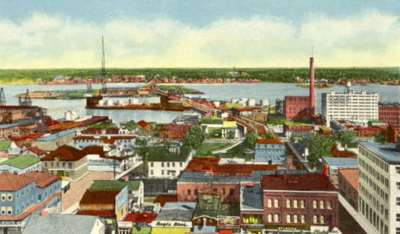
The "Octopus", where several streets merge at the foot of the bridge on the western (New Bedford) side is not
built yet in this picture giving us a general timeline by which to date the photo.

The current Route 18 is not yet created in this painting.
If you click on the image it will enlarge and then click your mouse over that image and it will be able to enlarge it again quite a bit more, showing greater detail.

Colorized photographs and paintings made from photographs were common in earlier times.
A lot of the old postcards postcards used this kind of artwork.
Go to the other pictures of the bridge to see some fascinating historical paintings and photos.

This is the view is looking toward Fairhaven.

(click the picture for a larger image)

1900's new Bedford Fairhven Bridge - www.WhalingCity.net


www.sailorsongs.com www.ourwholeworld.com www.Taxman123.com www.RC123.com
www.rogerchartier.com www.moneytopaythebills.com www.menujoy.com