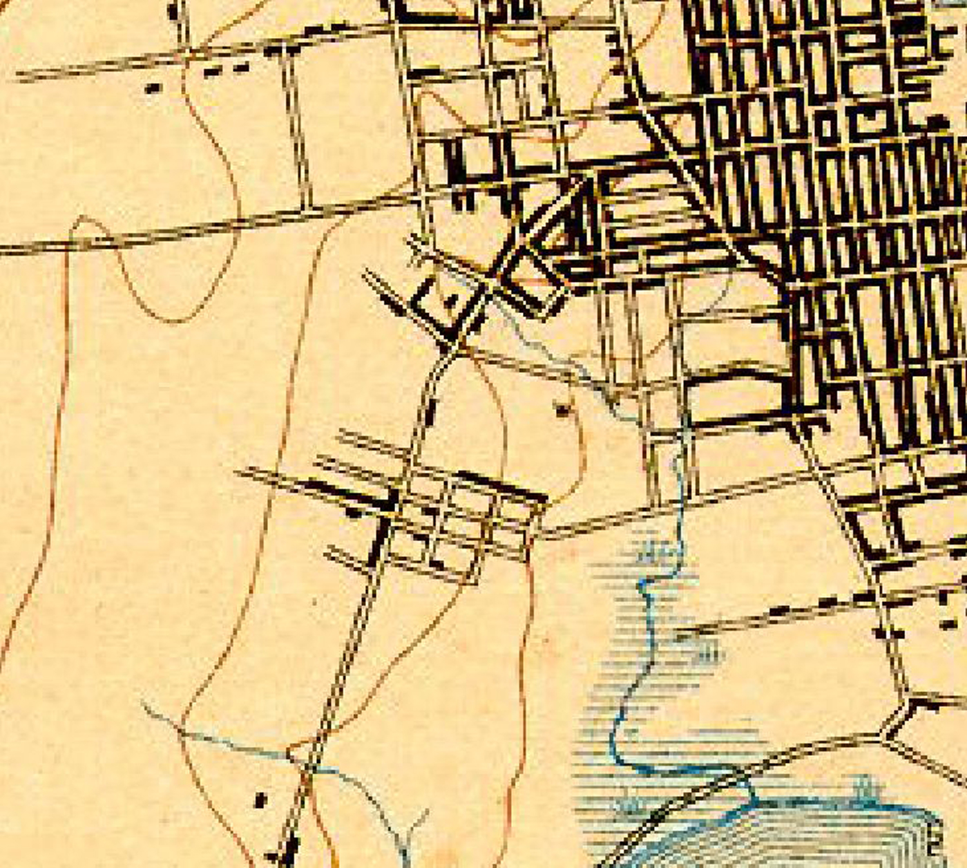
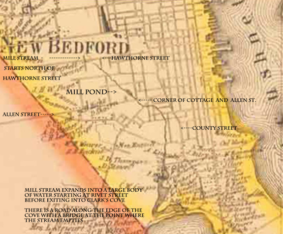
The Mill Stream and Pond Maps in 1858
New Bedford, Ma. |
| |
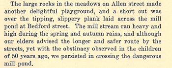
The text on the right was written by and about
Maud Mendall Nelson's experience in New Bedford around 1864.
There was a mill stream that travelled from a point north of Hawthorne street as you can see in the maps below to the Clark's Cove.
|
At a point just northwest of the intersection of Allen Street and Cottage street that was also accessible from Bedford Street there was a mill pond.
There is a small image on another map that might locate the mill itself on Allen Street, but that is questionable.
As the stream wound it's way through the city, it can be seen that part of Cottage street today (then called South Cottage Street) ended at Allen Street. What is a street today between Allen Street and Dartmouth Street was actually not a street but the stream bed itself. It's all filled in now of course.
As the stream found it's way to the south and emptied into Clark's Cove, it expanded into a large area of marsh and tidal basin. That is under a large tract of land now It is filled in and built upon. At the bottom of the cove was the Cove Road and the small bridge crossing the narrowed outlet of the stream into the Cove. |
Click all 3 maps for enlargement and more detail |
 |
| Below the map is showing the Mill Stream in 1893 a bit moved. It's section that was north of Cottage street including the mill pond is filled in and now starts just a bit south of that point.. The stream was quite diminished due to land fill. |
 |
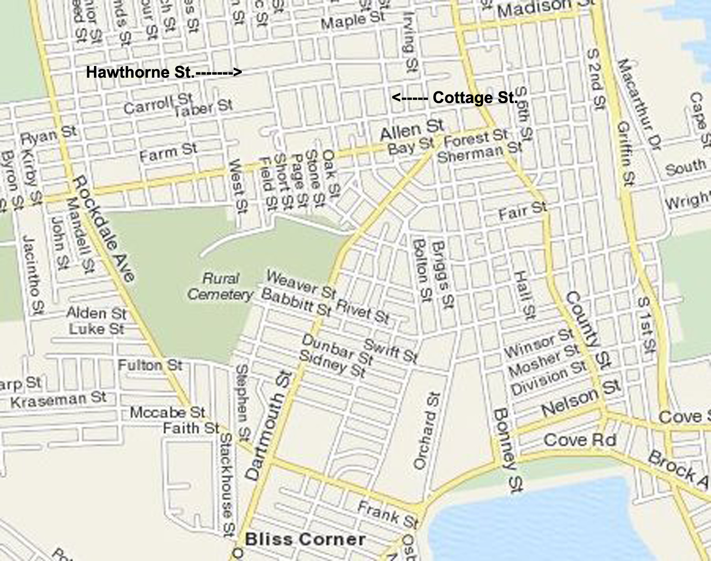
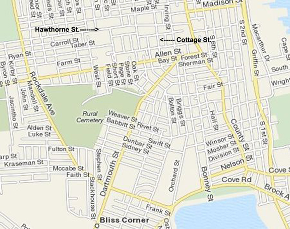
| Below is a present day map as a reference |
 |
|
|