If you have any public domain photographs of historical interest to donate, whether scanned or printed please contact the webmaster, Roger Chartier and your submission will be credited if it is displayed on this site.
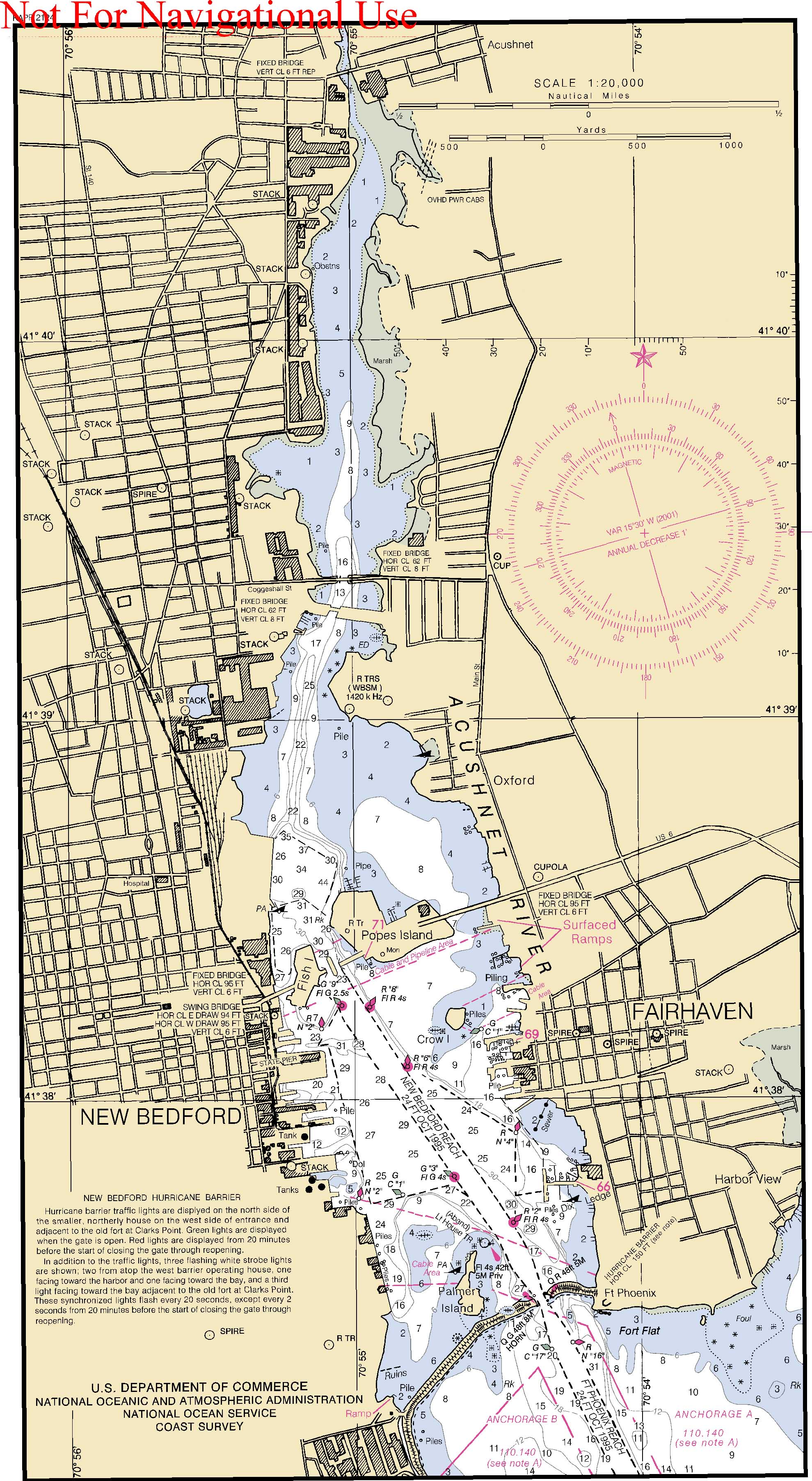
This older nautical chart shows depths and objects and aids to navigation as well channel depths and place names for the nearby land masses. Navigational aids are shown. It is no longer appropriate for navigational use. The hurricane barrier built 1963 - 1966 is shown.