If you have any public domain photographs of historical interest to donate, whether scanned or printed please contact the webmaster, Roger Chartier and your submission will be credited if it is displayed on this site.
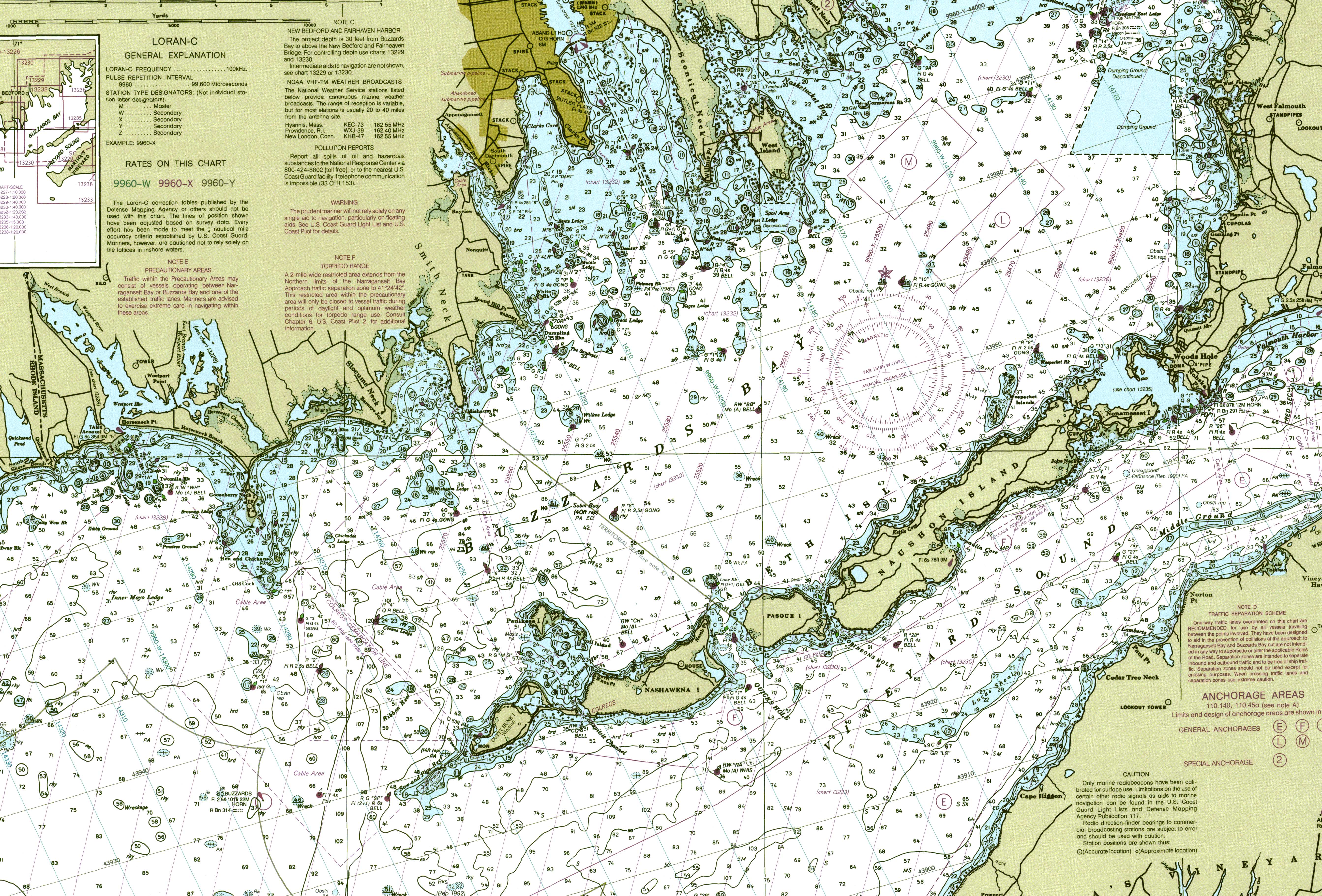
The nautical charts shows depths and objects and aids to navigation as well and place names for the nearby land masses. Navigational aids are shown. Great attention is paid for the various depths in all bodies of water shown