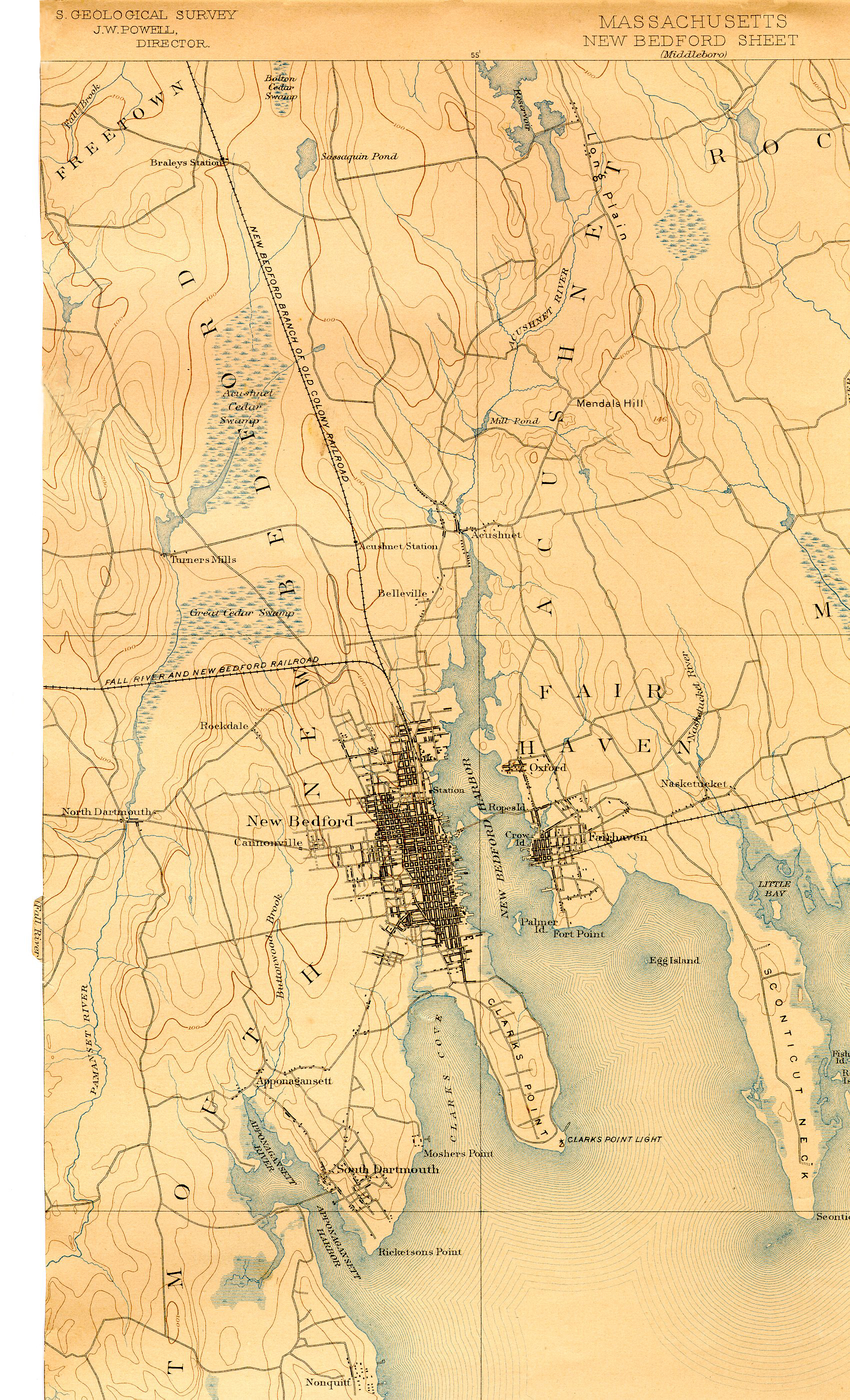
This is an 1893 map of New Bedford depicting topography and the nature of the land and water depth contours.
You can see the small creek that emptied into Clark's Cove. It was named "Bedford Creek" and included a small pond north west of what is today the intersection of Cottage and Allen Streets.
It has been totally filled in since that time. In various maps over the yearsthe creek and pond is depicted as shorter and smaller, and in some cases not there at all.